GeoSpock, the Spatial Big Data company, has launched its Spatial Big Data Platform 2.0 to reveal insights that supercharge business decision making.
Today’s database systems were created to solve the problems of previous decades, without the ability to scale and grow for the future. Machines are now generating data at a rate and scale beyond anyone's imagination, but databases are failing to keep up. GeoSpock’s new platform is designed to maintain consistent performance at the most extreme scales.
With limitless scalability, instant responsiveness and unparalleled throughput, the platform is perfectly suited to today’s data-intensive, real-time business systems, such as DataTech, Internet of Things (IoT) and unified telecommunications applications.
The Spatial Big Data Platform 2.0 provides unparalleled ease of use, giving users the ability to simply query vast quantities of data in real-time. It has flexibility at its heart, running an exposed system that can be adapted based on the use-case. When accessing and the data, the platform goes beyond 2D and 3D information, thanks to its unique design.
The system is able to handle otherwise computationally heavy, multi-dimensional queries with extreme efficiency. Together, these functions provide a level of data and query richness that enable businesses to complete highly complex operations at speed.
The solution is cloud-based and runs on AWS, meaning it can be accessed and managed from any location. It is able to seamlessly handle dynamic data sharing as well as automatic load balancing, which keeps the system responsive and quick to deploy even under heavy use.
The Spatial Big Data Platform version 2.0 contains the following features and functionality:
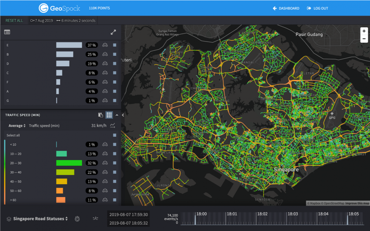
- Data exploration: The data exploration tool enables users to explore every facet of their data, whilst dynamically updating points on maps, time trend charts and statistics. The solution shows the results of a multi-dimensional filter that can include geography, time and geofences around Points of Interest (POI), among many other filters. Platform 2.0 also brings sub-second data access, a range of new visualisation modes, additional overlays and new ways to share insights.
- Flexible query engine and Business Intelligence tool connector - The tool enables users to perform in-depth analysis on the data ingested into the Platform, benefiting from the optimised indexes and the sub-second access to your big data.
- Data management - Platform 2.0’s ingestion engine supports a vast range of indexing, from geospatial, temporal, categorical, events and many others. The GeoSpock dashboard allows users to easily view all of their ingested data, as well as the activity list for each dataset. GeoSpock also assists all users with the process and ensure they get the best value out of the platform.
Other specifications:
- Minimal hardware needs
- Designed for Online Analytical Processing (OLAP)
- No limit to data volume - can process hundreds of terabytes of data
- Constant response times, faster than BigQuery in many cases
- SQL supported
- APIs for data ingestion and results in the roadmap
- Fully managed service
- SaaS in the roadmap
- Native cloud deployment
- Native geographical support
- Native temporal support


